toll-free (888) 647-9500
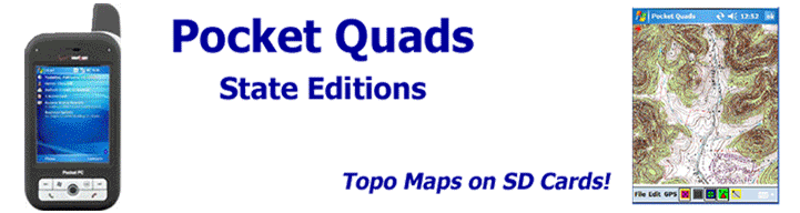
Powerful Software for the Latest Windows Mobile Devices
Our software supports:
Windows Mobile® 2003, 2003SE, and Windows Mobile® 5 devices
Windows Mobile® 2003, 2003SE, and Windows Mobile® 5 devices
- No PC needed, ever!
- No downloading maps!
- No searching for the right map, or selecting an area that you need!
- Just insert the card, install the software, and connect to your GPS receiver!
- Pocket Quads automatically loads the correct topo map based on your GPS position and tracks you in real-time. You never have to manually load a map...simply walk, hike, or drive!
Pocket Quads™ is the definitive topographic mapping software for Windows Mobile® devices. Each Pocket Quads Edition comes complete with our powerful Pocket Quads software and topographic maps pre-loaded onto SD or miniSD cards!
Pocket Quads is available in 3 different Editions:
- Pocket Quads US Regional Editions - 10 or more States on 2 4GB SD or miniSD cards for just $149.00! Includes all of the 1:100,000 and 1:250,000 scale topographic maps for an entire region.
- Pocket Quads US State Editions - Most States are now available for just $99.00 or $149.00! Each State Edition comes with all of the 1:24,000, 1:100,000, and 1:250,000 scale topographic maps for the entire State.
- Pocket Quads National Park Editions - New low price,
just $79.00! All of the 1:24,000, 1:100,000, and
1:250,000 scale topographic maps for individual parks,
listed below:
- Yellowstone & Grand Teton National Parks Edition
- Utah National Parks Edition
- Arizona National Parks Edition
- Big Bend National Park & Big Bend Ranch SP Edition
Coming Soon!
The most complete software and topographic trail map solution you can buy! Pocket Quads Trail Map Editions for Utah & Arizona with modified topographic maps showing marked trails brought to you buy Off the Beaten Path Maps!